Kandel
Startplatz Kandel (Kandel-West und Rampe) · Waldkirch, Baden-Württemberg, Germany · 66 flights a year · 66 in 30 days
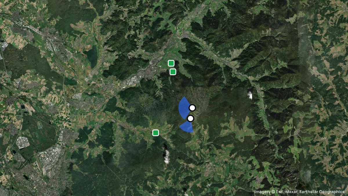
Paragliding site near Waldkirch, Baden-Württemberg, Germany, launching at 1,200 m with 840 m of height difference in SW, WSW, W, WNW, NW wind.
Eines der beliebtesten Fluggelände im Südschwarzwald. HG-Rampe, GS-SP auf Wiese neben der Rampe, Einweisung erforderlich! "Geländeordnung Kandel", insbesondere die Regelungen zum Schutz des Wanderfalken, beachten! Tandemflüge nur für Vereinsmitglieder. Landeplatzsituation in Glottertal kann sich kurzfristig ändern Mindestabstand zur Straße von 50 Metern einhalten Nur markierten Landeplatz nutzen. Aktuelle Landeplätze auf der Website des Clubs. Auffahrt zum Kandel mit Linienbus möglich.
Einweisung erforderlich. Infos: https://www.dgfc-suedschwarzwald.de/gaesteregelung-d/ Kraftfahrzeuge sind auf den dafür vorgesehenen Parkflächen (z. B. Parkplatz südlich des Kandelhofes) abzustellen. Die Zufahrt zum Startgelände ist unzulässig. Flugbetrieb darf ausschließlich bei Wind aus südwestlicher Richtung durchgeführt werden. Vor dem Start muss sichergestellt sein, dass sich keine anderen Luftfahrzeuge in Startrichtung und im näheren Luftraum befinden. Gleitsegelpiloten benötigen mindestens den unbeschränkten, Hängegleiterpiloten den beschränkten Luftfahrerschein. Alle Piloten sind in die Besonderheiten des Geländes, insbesondere in die lokalen Windverhältnisse, und in die Auflagen der Genehmigung einzuweisen. Vom unteren Startplatz (Flst. 75) darf nur mit Gleitsegeln gestartet werden.
When pilots fly here
Most flights start in September. Pilots usually launch between 16:00 and 19:00. A typical flight lasts 27 minutes. Thermals here climb 0.8 m/s on average. Most thermals drifted in W, SW wind.
From 66 flights the Open Glider Network saw start here in the last twelve months.
Pilot reviews
No reviews yet. Flown here? Tell other pilots how it went.
Step · Spot
Pick a launch: sites rated for the day, the most flown spots, valley wind, gusts and live stations.
Weather models
DWD ICON-D2 · 0.02° (~2 km)
Model guidance only. Terrain, launch conditions and winds aloft need a separate assessment.
Launches, landings and towing
Site
Hill site for paragliders and hanggliders · 840 m height difference
Paragliders: 1- and 2-seaters / training · Hang gliders: 1- and 2-seaters
Seen launching (OGN): 24 flights today · 50 flights in 30 days
Access: Car · On foot
Zufahrt über die Kandelstraße (L 186) möglich. Parkmöglichkeiten im Bereich Kandel/Rasthaus. Zusätzlich Anfahrt mit Linienbus; Vereinsbus/Shuttle je nach Betrieb.
Drachen-Gleitschirmfliegerclub Südschwarzwald e.V.
Spots nearby
- SteingrubenbergSt. Peter, Baden-Württemberg, Germany · 4.8 km away
- HörnlebergGutach-Bleibach, Baden-Württemberg, Germany · 7.2 km away
- LindenbergBuchenbach, Baden-Württemberg, Germany · 7.4 km away
- NiederwindenWinden, Baden-Württemberg, Germany · 7.8 km away
- HintereckGütenbach, Baden-Württemberg, Germany · 8.3 km away
- Tafelbühl WWinden, Baden-Württemberg, Germany · 8.6 km away
- All spots around Waldkirch