Layers1/1
Spot · Sites
- Flight sitesFlight sites opacity100%

Brauneck
Brauneck Startplatz Gipfel Nord · Lenggries, Bayern, Germany · 389 flights a year · 67 in 30 days

About Brauneck
Lenggries' cable-car mountain, with four launches for north, south and east winds and a day shaped by when the valley wind arrives.
- Cable car from Lenggries to four launches
- Up to 855 m height difference
- Landing card for guests at the ticket office
- Hourly train from Munich
The Brauneck (1,555 m) above Lenggries has a cable car with launches for north, south and east wind, and separate landing fields for paragliders and hang gliders. As an early thermal mountain, the valley wind decides which launch suits the moment.
Guide
Valley station: Gilgenhöfe 28, Lenggries, free parking. Trains run hourly from Munich to Lenggries, about a 25-minute walk or short bus ride away.
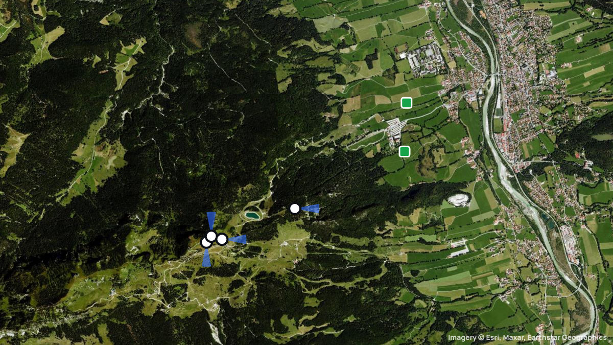
Four launches: North (1,555 m, only northerly PG launch), South (1,545 m), Garland (1,515 m, PG only) and Umsetzer (1,550 m), a backup in strong wind. Paragliders land at the valley station (left circuit), hang gliders on their own field.
Flyable in almost every wind except a strong pure westerly. Thermals often start by 10 am, most reliably at the Kotiger Stein. From midday the valley wind turns north: switch from the south launch via Garland to the north launch.
Guest pilots buy a landing card (five landings) at the ticket office, validate it per flight and show it unasked. Helmet and liability insurance are compulsory. From 1 Jan to 31 Jul a no-fly zone above Klein-Lanzarote protects a breeding eagle owl.
Thermal flying works on good days from February to October; in winter the south launch is often the only good option for miles. Garland and the new landing field stay closed while the pistes and trails run.
Cable car: Auffahrt mit der Brauneck Bergbahn (Drachen müssen auf 4,20 m kurz gepackt werden). Während der Skisaison sowie während der Herbstwochenenden vorher bei der Bergbahn nachfragen.
Das Brauneck bietet Startplätze nach Norden, Süden und Osten. Mittags setzt häufig der Talwind ein, der dann das Isartal hinauf bläst. Am Startplatz Garland (Ost) wird es dann gerne turbulent. Auffahrt mit der Brauneck Bergbahn (Drachen müssen kurz gepackt werden - 4,20 m). Flugschule Adventure Sports ist in der Talstation der Brauneckbahn zu Hause.
1. Die Gleitschirmstarts nach Norden sind auf den Startplatz Nord bei der Windmessanlage beschränkt. Keine Starts am Kirchstein. 2. Die Nordseite des Höhenrückens Brauneck-Benediktenwand ist zum Schutz von Wildtieren vom Startplatz Nord Richtung Westen / Benediktenwand in einer Flughöhe von mindestens 150m zu überfliegen. 3. An den Wochentagen (Mo-Fr.) ist das militärische Tiefflugband von 150m - 450m über Grund möglichst zu meiden bzw. so schnell wie möglich zu durchfliegen. 4. Der Flugbetrieb mit Hängegleitern und Gleitsegeln darf nicht aufgenommen werden, wenn Übungen mit Bundeswehrhubschraubern geplant sind. 5. Am Gleitsegelstartplatz Nord / Windmessanlage sind keine Ausbildungsflüge gestattet. Starts sind nur bei Nordwind erlaubt. Nach dem Start ist rechtzeitig in Richtung Landeplatz abzudrehen. 6. Am Startplatz Süd für Hängegleiter und Gleitsegel ist Ausbildung nur durch eingewiesene Fluglehrer gestattet. Flugschüler müssen zuvor mindestens 10 Höhenflüge in anderen Fluggeländen absolviert haben. 7. Am Gleitsegelstartplatz "Garland" ist Ausbildungsbetrieb (auch Doppelsitzer) nur durch eingewiesene Fluglehrer gestattet. Die Windbedingungen müssen einen gefahrlosen Überflug des Garlandsattels gewährleisten. Die Schüler sind auf die besonderen Bedingungen des Geländes hinzuweisen.
When pilots fly here
Most flights start in September and October. Pilots usually launch between 12:00 and 15:00. A typical flight lasts 1 h 48 min. The best flight climbed 779 m above launch. Thermals here climb 0.9 m/s on average. Most thermals drifted in SE, S wind.
From 389 flights the Open Glider Network saw start here in the last twelve months.
Pilot reviews
No reviews yet. Flown here? Tell other pilots how it went.
Spots nearby
- BlombergWackersberg, Bayern, Germany · 7.9 km away
- BerghaldePenzberg, Bayern, Germany · 15 km away
- BucherhangBad Wiessee, Bayern, Germany · 15 km away
- PrombergPenzberg, Bayern, Germany · 18 km away
- BuchbergGmund, Bayern, Germany · 18 km away
- HabachHabach, Bayern, Germany · 19 km away
- All spots around Lenggries